Dealing with shifting skies, unpredictable storms, and limited connectivity — staying safe is a high-stakes challenge. Now, thanks to a powerful collaboration between the UK Met Office and the lone-worker safety specialist Trackplot, weather data is being turned into real-time protection.
—
From Data to Decisions
Trackplot specializes in monitoring and safeguarding employees working alone in remote or hard-to-reach zones. By integrating two key Met Office services — the National Severe Weather Warning Service (NSWWS) and Met Office DataPoint — it now delivers hyperlocal weather intelligence directly into its platform.
Through DataPoint, managers can see the exact weather conditions at a worker’s location. And with NSWWS, real-time alerts are triggered inside Trackplot when conditions turn severe. These warn workers via SMS, email, or even automated voice calls — giving them precious lead time to adjust plans, reroute, or pause operations before disaster strikes.
—
Why This Matters — Especially Now
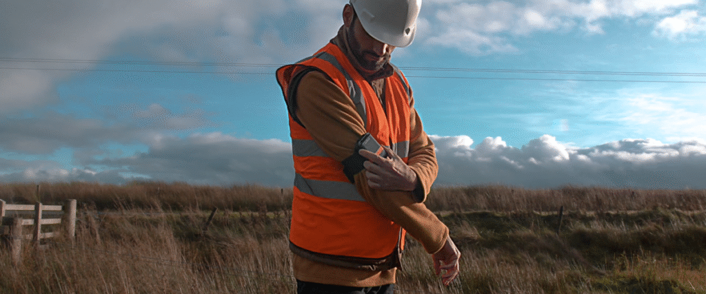
Outdoor lone workers face unique risks. Unlike teams in urban settings, they often operate far from support, sometimes beyond mobile coverage. Bad weather can exacerbate everything from heat stress to exposure to torrential rain or freezing cold.
Meanwhile, climate change is making conditions more extreme — and less predictable. The Met Office anticipates winters will warm by 0.5–3.2 °C, rainfall intensity might rise by as much as 25%, and wet spells may be more frequent. That makes having dynamic, localized weather intelligence not just useful, but essential.
—
Real Impact, Real Industries
The benefits are showing up across sectors:
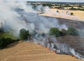
Forestry & land management: Teams can schedule timber operations between storms to reduce delays and hazards.
Field services & infrastructure maintenance: Route and schedule decisions become more informed, minimizing the risk of sending individuals into dangerous weather pockets.
Emergency response & remote rescue: If a lone worker is caught in severe conditions, real-time data allows managers to prioritize coordination, triage, and safe extraction.
One Trackplot technical lead, Gert Riemersma, said, “The Met Office Data Service was the obvious choice … the data needed to be easy to visualise on maps for a quick ‘at a glance’ interpretation.”
—
Built for Growth
Trackplot’s choice to partner with the Met Office wasn’t just about data quality — it was about access and flexibility. Licensing options (including open and government-friendly licenses), easy scalability, and Met Office credibility made it a natural fit.
Moreover, this collaboration is designed to evolve. As both organizations expand their data services, new capabilities can be layered — further boosting worker safety and responsiveness.
—
In an era when changing weather patterns are the new norm, combining meteorological intelligence with field operations is no longer just an advantage — it’s a necessity. The Met Office–Trackplot case shows how, with the right data delivered at the right time, lone workers can be protected — even when they’re on their own.